
Winnipeg is the capital city of Manitoba, and the largest city in the province. It is the seventh most populous municipality in Canada.
Winnipeg
The 2011 Transportation Master Plan commits the Winnipeg to “Move to a road classification system that recognizes multi-modal travel needs and the concept of “complete streets”. Section 5.1.3, within the section on Transportation Choice, is completely dedicated to Complete Streets. This includes an overview of complete streets features and enabling strategies for the city to implement.
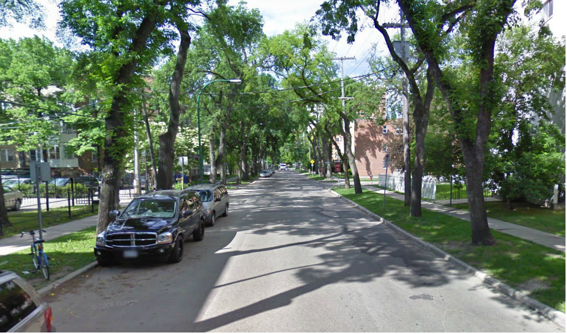
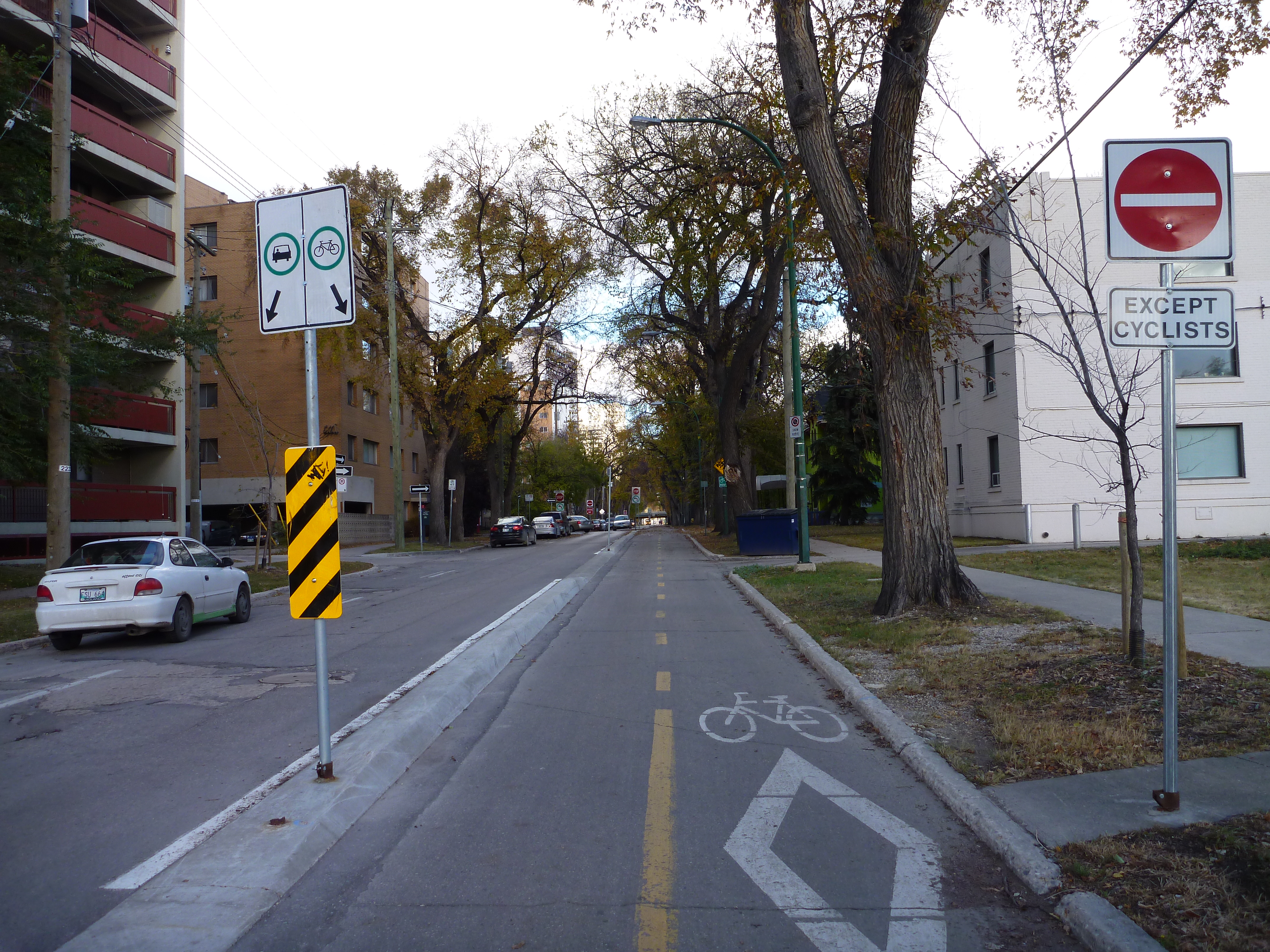
In 2010, Assiniboine Avenue, a key route through downtown, was redesigned to become one of Winnipeg’s first examples of a Complete Street providing a high-level of mobility for all road users.
Today, Assiniboine Avenue is well known for having the City’s first separated bikeway. In addition, the redesign included improvements to pedestrian infrastructure including detectable pavers and curb bumpouts to shorten pedestrian crossings. The addition of the bikeway had little impact on transit service as no regular service runs on Assiniboine Avenue apart from one midday shuttle that operates between Garry Street and Fort Street.
Winnipeg Bike volunteers have completed cordon counts on Assiniboine Avenue at Hargrave Street since 2009 and have found that the number of cyclists has increased by over 350% since the separated bike lane was complete.* This project was also featured in a paper presented at the Transportation Association of Canada Conference in 2010, titled: Development of the Assiniboine Avenue Bikeway in Winnipeg, Manitoba.
The City of Winnipeg has recommended the development of a city-wide Complete Streets policy in their 2011 Transportation Master Plan.
* Based on 2 hour cordon counts conducted at Assiniboine Ave. and Hargrave St. during the afternoon rush hour. Latest data showed an average of nearly 500 cyclists in the 2hr window. See the 2015 report.
Complete Communities is Winnipeg’s “playbook” guiding land use and development to create unique, sustainable, and complete communities.
Within section 3 on Transformative Areas, complete streets is mentioned within their direction and enabling strategies on creating new communities; Direction 4 states that “New Communities will be developed with Complete Streets (See Sustainable Transportation), enabling safe and convenient spaces for pedestrians, bicyclists, public transit ridership and motorists to promote physical activity, health and active transportation.” (p.76).
The Winnipeg Pedestrian and Cycling Strategies was developed in 2014 and approved by council in 2015. It was developed as a result of the implementation of their Transportation Master Plan. The Pedestrian Cycling Strategies “seek to maximize transportation options by ensuring the accessibility, comfort, and safety
of walking and cycling in Winnipeg, and to establish directions for walking and cycling policies, infrastructure, and programs over the next 20 years and beyond” (p.vii).
Part 2 “Shaping Influences”, Complete Streets is mentioned as related to the guide Complete Communities and its walking and cycling strategies. It also links complete streets to its directions of sustainability and those of the Transportation Master Plan.