• Skip to primary navigation
  • Skip to main content
Complete Streets for Canada

Complete Streets for Canada

  • Map
  • Resources
  • News
  • About
Back to map

Vancouver

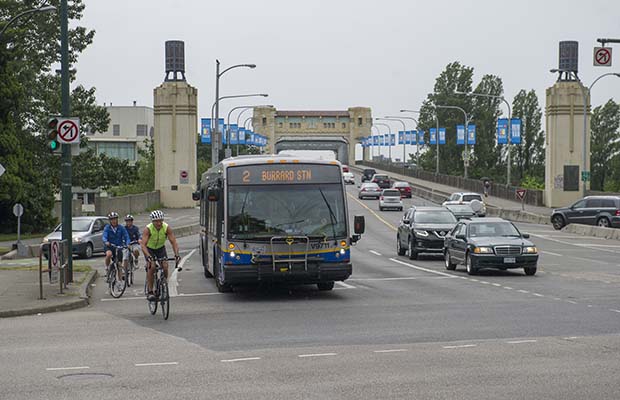
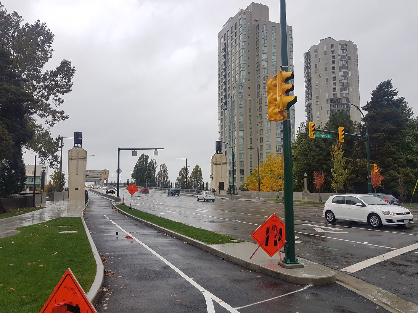
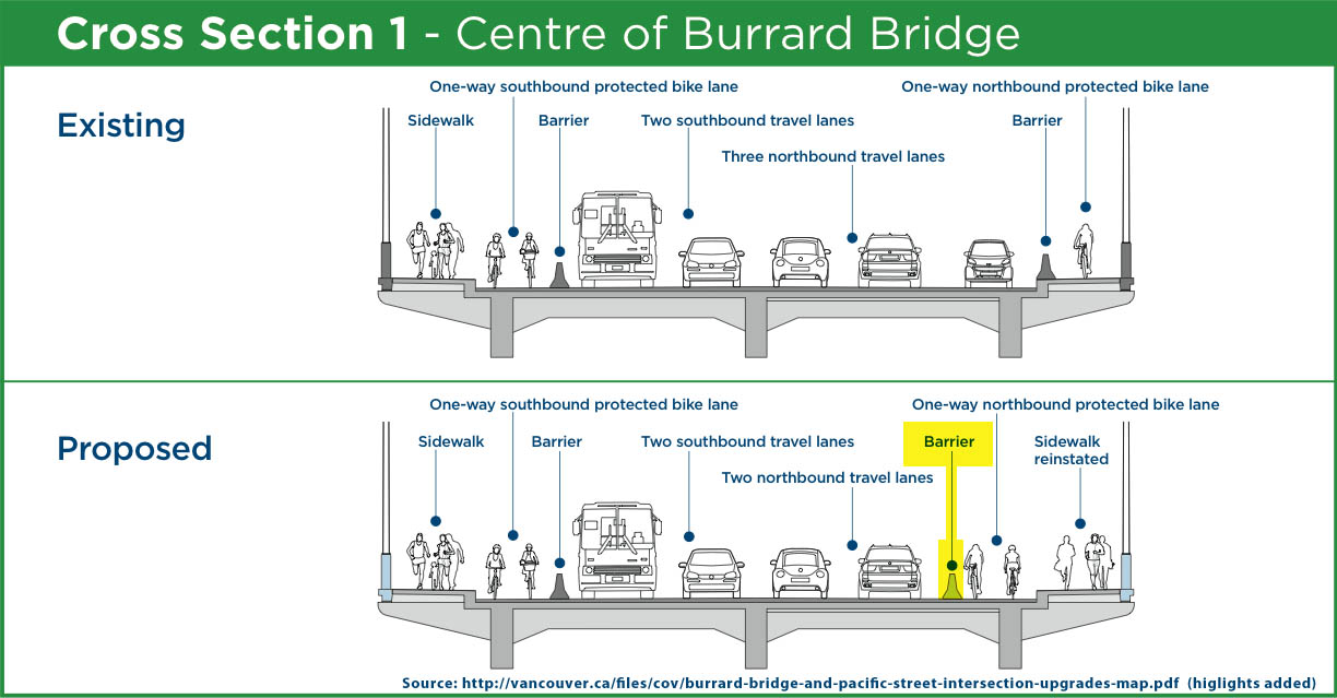
Vancouver, the most populated city in British Columbia, is a Canadian leader in building and designing “all ages and abilities” cycling infrastructure. In 2017, Vancouver adopted a Complete Streets policy framework including a traffic by-law giving the City Engineer delegated authority to make street modifications to support safety and mode share targets to deliver Complete Streets. The city has seen a major modal shift towards cycling, walking and transit in recent years thanks to strong policies, integration with existing guidelines, and funded implementation plans.

A blog post highlights a Complete Streets transformation of a Vancouver bridge.

By-laws & Council Resolutions | 2017

In 2016,  Vancouver City Council adopted the City’s 2016-2021 Strategic Plan. Action 1.1.1 of the Strategic Plan is to “Adopt and implement a ‘Complete Streets’ program (e.g., designed and operated to enable safe mobility for all users).”

In April 2017, City of Vancouver staff submitted a recommendation to Council that the City adopt a dedicated Complete Streets Policy Framework and modernized the City Engineer’s delegated authority within the Street and Traffic By-law to allow minor streetscape alterations in accordance with Complete Streets design principles without the requirement of council approval (a similar capacity to make street changes on behalf of motor vehicles has existed since 1944).

On May 16, 2017, City Council referred this item to the Standing Committee of Council on City Finance and Services in order to hear from speakers. On May 17, 2017, the Committee, and subsequently City Council, approved the Complete Streets Policy Framework and Related By-law Changes to facilitate street modifications to support Transportation 2040 safety and mode share targets and delivery of more Complete Streets. Council minutes can be found here, and a video recording, including a presentation by engineering staff, can be found here.

Guidelines and Standards | 2017

The Complete Streets Policy Framework was created following a recommendation to City Council in 2017. Complete Streets policy is especially relevant to Vancouver’s goals for their Transportation 2040 plan (see Transportation Plan below).

This comprehensive document goes on to outline the benefits of a Complete Streets approach, main Complete Street principles, street typologies and network considerations, identification and strategic prioritization of Complete Street corridors, funding and delivery, and implementation considerations. Street and traffic by-law amendments specific to the Vancouver context are also included.

The document ends with next steps for Complete Streets planning and even references the NACTO Global Street Design Guide as a guiding document for Vancouver’s planning strategies.

Sustainability Plan | 2015

Vancouver’s “Greenest City 2020 Action Plan” is a strategy for ensuring Vancouver stays on the leading edge of urban sustainability practices. The strategy prioritizes using “land-use and zoning policies to develop complete compact communities and complete streets that encourage active transportation and transit” (p. 25).

Strategic Plan | 2015

Vancouver’s 2015 “Renewable City Strategy: 2015-2050” advocates for the acceleration of Complete Streets in the city, while also proposing to “use land-use and zoning policies to develop complete compact communities and Complete Streets that encourage active transportation and transit” (p. 42).

Complete Streets redesigns are underway on Georgia Street, Commercial Drive and in the Gastown neighbourhood, which are all major destinations for visitors and residents. Commercial Drive is included in the 2016 “Grandview-Woodland Community Plan“, which adopts a Complete Streets approach for the area (p. 139-140).

Transportation Plan | 2012

The City of Vancouver’s 2012 “Transportation 2040 Plan” does not use the term Complete Streets explicitly but it refers to the same principles. The Plan establishes a modal hierarchy that places walking, followed by cycling and transit, at the top of the scale (p. 16). It also commits to building streets that accommodate all users using a context-sensitive design approach.

Case Study | 2017

Bike Lane Pilot

For well over a decade, Vancouver’s Burrard Street Bridge was a hotly contested piece of asphalt. In 1996, what was supposed to be a six-month trial that converted one lane of traffic into a bicycle lane only lasted a week, due to public outcry. From 2005 to 2009, proposals to again trial bike lanes or expand the sidewalk were stymied by rising costs and concerns from motorists, heritage preservationists and the Squamish First Nations group, whose land falls under the bridge. With the Olympics coming in 2010, the City finally agreed to a trial that reduced the number of vehicle lanes on the west side (heading out of downtown) to two and added a separated bike lane. Three vehicle lanes were maintained heading into downtown, and the sidewalk on that side was reserved for eastbound cyclists. Pedestrians were restricted to the sidewalk on the west side.

The trial was extremely successful in increasing bicycle traffic, with the City of Vancouver reporting 24% more bicycle trips over the bridge between July 13, 2009 and July 12, 2010. This amounted to an additional 200, 000 bike trips in one year. Growth on summer and fall weekends was the most dramatic, with volumes up 40-70%. A study by the University of British Columbia indicated that accident rates for cyclists on the Burrard Street Bridge decreased, and the process was also the focus of a research paper at the University of Toronto, titled, “”The politics of bicycle lane implementation: The case of Vancouver’s Burrard Street Bridge. Vancouver City Council voted to make the bike lane permanent in July 2010.

Complete Street Redesign

Although the trial bike lane was successful in improving safety and access for cyclists, it also limited pedestrian use to the west side of the bridge. Because of its limited capacity, a redesign was needed to enhance access for all ages, abilities and modes of travel.

In 2015, the required replacement of water and sewer infrastructure provided the redesign opportunity to make the bridge a Complete Street. Due to policies adopted by Council, city staff produced a redesign using a Complete Streets approach for this significant piece of infrastructure and for its northern intersection at Pacific and Burrard. At a cost of $35 million, the redesign shows a major improvement in function of the bridge and intersection. Specifically, the changes have improved safety and comfort for all users, maintained previous traffic flow and car volumes on the bridge during peak hours, and preserved the historic and aesthetic value of the bridge.

The most significant changes were subject to heavy discussion and debate at Council and among civic groups alike. This was due to the removal of a southbound traffic lane on the bridge, to provide two-way separated bike lanes and sidewalks on both sides of the bridge. According to Vancouver planning staff, the redesign will not significantly affect traffic times or congestion, and has maintained previous traffic conditions leading northbound into downtown Vancouver.

After 18 months of construction, this iconic Vancouver bridge was reopened with a Complete Street redesign on October 21, 2017.

The Burrard St Bridge changes are as follows:

  • The reintegration of sidewalks on both sides of the bridge
  • The removal of one southbound traffic lane, to properly provide for separated bikes lanes in both directions
  • Barriers added between motor vehicle traffic and bicycle lanes
  • Street lamps and pillars added, which also provide stability for discrete anti-suicide fencing
  • Pacific and Burrard St intersection changes are as follows:
  • Widened the intersection nearly 100m
  • Replaced slip lanes with dedicated bicycle lanes, effectively providing protection against right hook collisions
  • Added dedicated turn lanes
  • Created protected signal phases for different road users and turn movements
  • Increased separation between people walking, cycling, and driving
  • Sixty trees were planted in the intersection and surrounding blocks, and the large cypress tree at the intersection was protected
Before
After
Cross Section
Facebook  Twitter  Linkedin 
Subscribe

The Centre for Active Transportation logo

a project of
Clean Air Partnership logo